Knowledge Base
Explaining Existing Conditions Drone Services
The role of drones in reality capture and building documentation continues to evolve rapidly every year. With billions of dollars in research and development going towards the unmanned aerial vehicle industry, many previously cost-prohibitive services are now within reach of most professionals within our industry.
Existing Conditions' FAA-certified pilots can help you leverage drones to the fullest. When combined with an exterior building scan using terrestrial 3D laser scanning, clients often find our aerial drone surveys to be a great alternative to a full 3D Revit model or CAD exterior elevations.
Types of Drone Data
There are two primary types of data sets that can be captured and delivered using drones: visual media, and photogrammetric models. Drone media primarily consists of high-definition digital photographs and video clips. Photogrammetric models are digital 3D models that are created using photographic data to determine the characteristics of the built environment. Both types of data sets can help document buildings when cost, accessibility and safety are top priorities.
If you have special flight specifications for our FAA-certified pilots, we request that you provide as much detail as possible for our team to use as reference.
Visual Media
Through Existing Conditions' drone flight operations, our FAA-certified team can capture data over a large physical area in a relatively short amount of time. These data sets will often contain hundreds of high-resolution digital images and video clips. Leveraging this set of visual media can reduce time on site and in processing, saving our clients on the overall cost and schedule of their projects. When it comes to accessibility, drones allow our team to visually access spaces where terrestrial 3D laser scanning may not be viable.
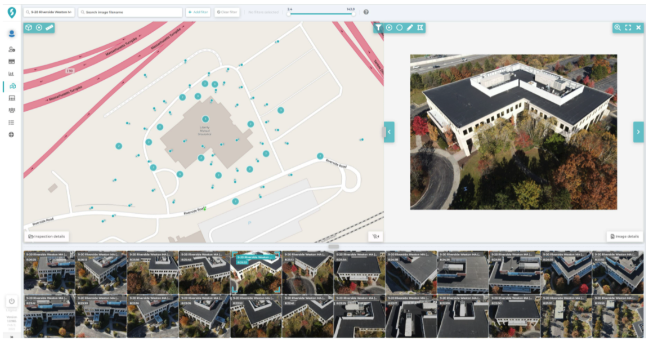
For example, if a building is abutting a body of water, or if there is no adequate access to the rooftop, our FAA-certified team can use a drone to augment other components of the data set. Safety is always a top concern for our field operations teams, as well as our on-site partners, and drones can mitigate the necessary exposure of crews to unsafe conditions such as fire damage, decaying infrastructure, or hazardous air quality.
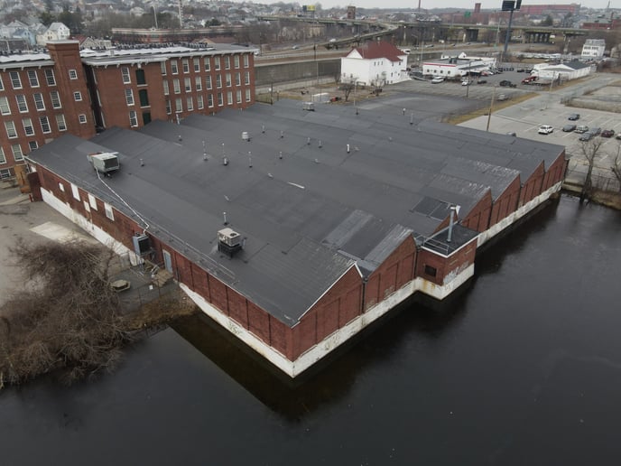
Once our team has captured a satisfactory set of visual data, we are able to collate that information, analyze it, and report on it. This process allows for delivery of both an online and PDF report. Our team effectively turns visual inspection images into valuable asset insights, saving our clients time and money. Visual analysis is another tool in our toolbox. Just as a 3D laser scanner has its own strengths, there are instances where a visual survey via drone will provide a client with the best data for their needs. This is often the case when a client needs to perform a visual assessment of a facade or roof but does not need measured drawings to do so. In these scenarios, high-resolution visual media captured by drone is the best approach for the job.
Visual surveys also can be tied to the specific date of capture. When flights are executed repeatedly, clients benefit from the increased insights that come through repeat inspections. Whether a new building is inspected for construction progress, or a roof is inspected to determine the rate of deterioration, historic comparisons allow clients to understand how time impacts their projects.
Photogrammetric Models
Photogrammetry refers to the science of using photographs to generate a set of accurate measurements. Existing Conditions can leverage sets of photographs and use photogrammetry to build a digital 3D model that helps clients save on cost in a variety of ways. Performed at the beginning of a project during the due diligence phase, clients can use photogrammetric models to avoid being forced to erect scaffolding in order to adequately survey the upper levels of a building's façade. Façade documentation by drone survey can provide a detailed perspective of every square foot of a building in a high resolution color image. Drones allow access to the out of reach upper floors of a high-rise that can not be reached with traditional scanning, allowing the client to save time and money. Given that the massing of many high rise buildings are "stepped-back" as the building rises, a drone survey provides a perspective that would otherwise be unattainable from street level.
Our Visual Media Deliverables
We typically deliver a minimum of 15 high-resolution aerial images and 5 high-definition aerial video clips, though our work is always driven by the client's scope. For some projects, we are also capable of delivering an accessible online 3D model to use for facade and roof inspection (example above).
For quality control purposes, our FAA-certified pilots are provided with a standard set of instructions.
- Standard Shot List
- Images are captured at 100' and 350' from the cardinal directions (N, NE, E, SE, E, SW, W), according to FAA height restrictions and project scope
- Panoramas will be taken at 100', according to FAA height restrictions and project scope
- Videos are captured from a variety of different angles and altitudes to provide multiple perspectives of the property. We often work closely with our clients to highlight specific areas of the property or local features in the project vicinity.
- Standard Time
- The flight time is typically between 11 AM and 2 PM in order to work in optimal lighting conditions. If you would like to request that we capture imagery and video at a specific time frame, simply let us know in advance. Please note that flights completed outside the typical 11 AM - 2 PM time frame may be subject to harsh shadows or glare, due to the fact that the sun will be lower in the sky.
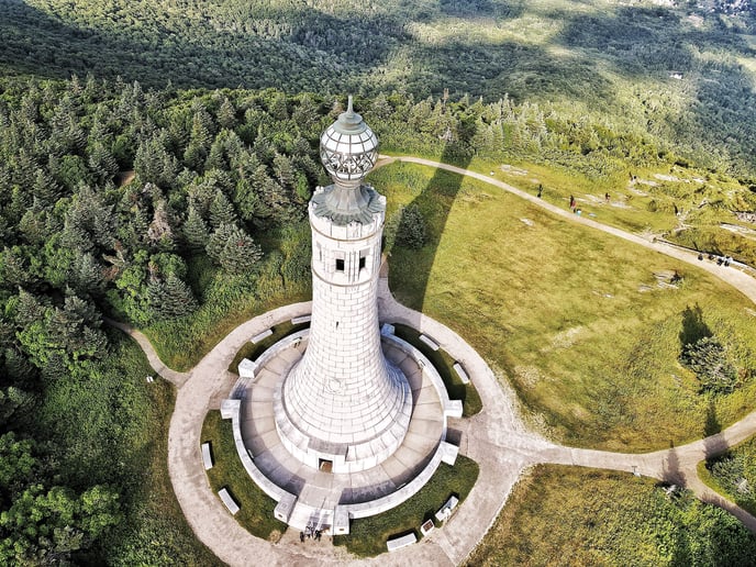
Please note that adverse weather conditions or supplemental requirements may lead to an extended timeline for the imagery delivery as our FAA-certified pilots may need to reschedule in order to fly safely and capture the best imagery possible.
For specific requests around preferred date and time, we will do our best to accommodate your specific needs.
Download e-Book on Existing Conditions Drone Surveys
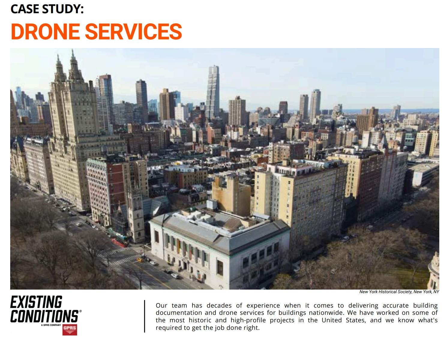
Existing Conditions Drone Survey Services
Over the past 27 years, we have measured, documented, and modeled over 10,000 buildings spanning over 700 million square feet across the United States, establishing ourselves as an industry leader in 3D laser scanning. Architects, builders, engineers, developers, and facility managers, trust us to deliver digital representations of the as-built environment with unparalleled accuracy and efficiency. Our dedicated Project Managers provide fast and accurate 3D laser scanning services and drone imagery services, and expert CAD and BIM technicians create custom, detailed deliverables. Our greatest reward remains delivering superior-quality scan-to-BIM work and knowing we played a vital role in our clients’ unique and historic projects.
Contact us today for a free project estimate.
Related Articles


.svg)


