

Drone Surveys
We deliver building and site documentation with professional drone surveys–delivering high-resolution aerial drone video and imagery, point clouds, 2D maps, othormosaic maps, volumetric measurements, 3D meshes, 3D models, and 3D flythroughs–operated by our FAA-licensed pilots.
Existing Conditions is more than a drone service provider, we offer complete site surveys, building surveys, and façade surveys to produce highly accurate digital deliverables for assessment, planning, monitoring, and inspection.
Drone surveys can help you:
- Capture high-resolution photos and video
- Safely inspect hard-to-reach areas like roofs and façades
- Avoid renting heavy equipment like cranes or scaffolding
- Document projects from preconstruction to closeout
- Detect damage, cracks, and water pooling
- Gather topographic data for geo-referenced 2D orthomosaic maps
- Acquire complete site as-builts by adding 3D laser scanning

.avif)
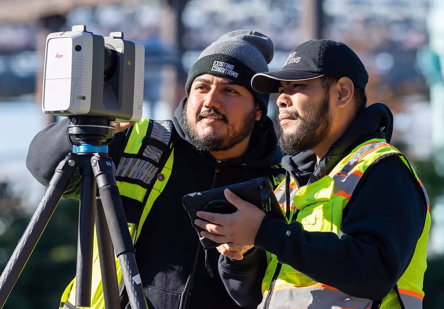
Drones are transforming industries with advanced site surveying and aerial mapping.


%20(1).avif)

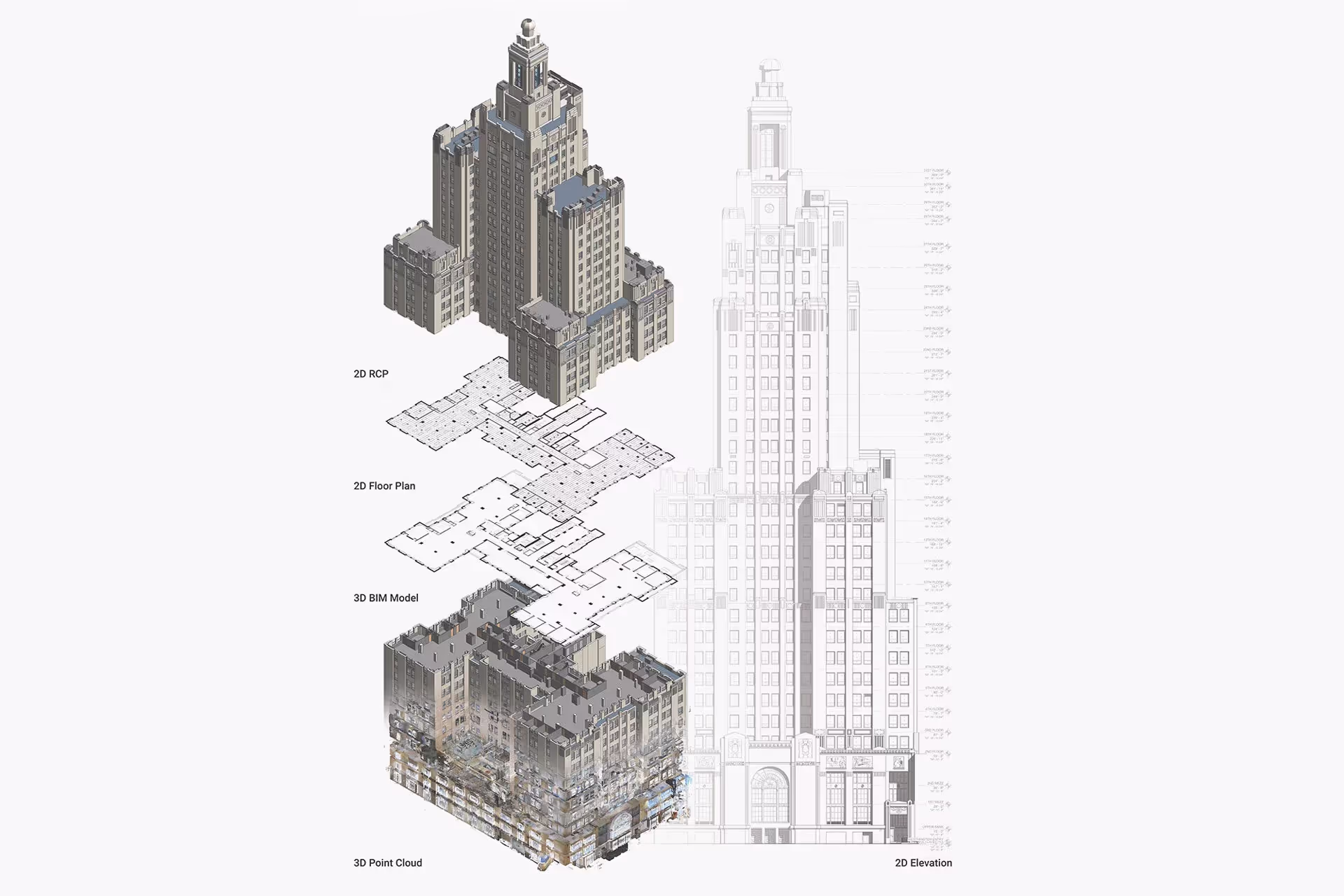
What Data and Deliverables Can You Get From a Drone Survey?
Drone Video & Imagery
.svg)
Point Cloud
2D & 3D Orthomosaic Maps
3D Models
3D Mesh
3D Flythroughs
What Data and Deliverables Can You Get From a Drone Survey?
Drone Video & Imagery
Point Cloud
2D & 3D Orthomosaic Maps
3D Models
3D Mesh
Start Accurate. Stay Accurate.

Trusted Partner
Expert Team

Comprehensive Data Capture

As-Built Drawings & 3D BIM Models

Trusted Partner

Expert Team

Comprehensive Data Capture

As-Built Drawings & 3D BIM Models
Industries We Serve
Architecture

Construction

Facilities Management

Engineering

Commercial Real Estate

Entertainment


Our 3D Laser Scanning Process
.jpg)
Frequently Asked Questions
What is a Drone Survey?
A drone survey, also known as aerial surveying or drone mapping, is the use of an unmanned aerial vehicle (UAV) to collect data from the air to create maps and models. Drones are equipped with cameras and sensors to capture high-resolution images and other data. The data is then processed to create detailed maps and models of the area being surveyed.
What is a Digital Twin?
A digital twin is highly complex 3D virtual model of a physical building or infrastructure project that is the exact counterpart (or twin). Existing Conditions uses 3D laser scanners to collect real-time data in the form of point cloud and create a digital twin. Data can be easily visualized, measured, and analyzed. Digital twins can be used to improve efficiencies, optimize workflows and detect problems before they occur.
How is CAD different from BIM?
CAD is technology and software designed to produce precise technical drawings —replacing manual hand-drawn and drafting techniques with a digital process. CAD is used in many fields, including architecture and engineering, to create accurate and efficient representations of sites.
BIM, or Building Information Modeling, is a process of visualizing a digital representation of a physical asset via the 3D model and includes richer levels of data, including information on materials and equipment. Architects, engineers, and construction managers can track and monitor a building through its entire lifecycle, from initial design to construction, operations, and maintenance. Project teams can collaborate, share information, and monitor project costs using BIM.


