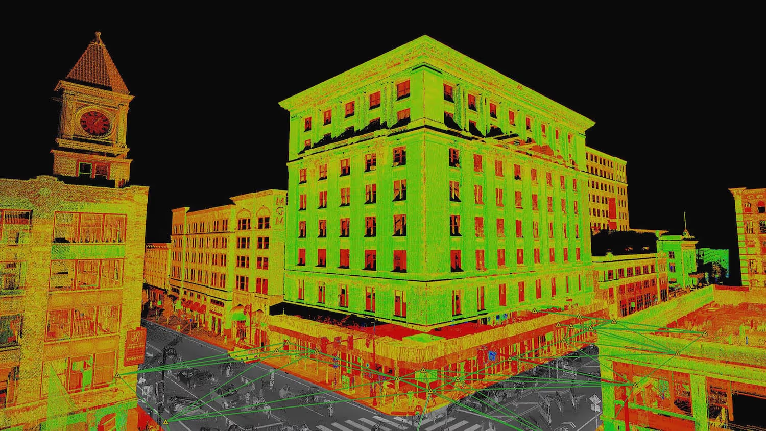
3D Laser Scanning and BIM for Commercial Real Estate

3D Laser Scanning and BIM for Commercial Real Estate
Laser scanning and BIM are foundational digital assets that have been providing situational awareness and actionable data to the commercial real estate industry for years. Commercial real estate (CRE) professionals like JLL have been utilizing this technology in ways that will benefit the industry (and clients) forever. CRE professionals can obtain precise 3D visuals of the properties they’re brokering or managing, and there are several major advantages to having this information on hand.
Sell your ideas
A 3D visual of the ideas they’re proposing to clients, communities, and other stakeholders is an incredibly useful tool for CRE professionals. This information allows them to display their ideas for a large building or property in a way that a 2D drawing or a verbal description never could. Selling your ideas and getting stakeholders on board becomes a much more direct process with the power of 3D laser scanning and BIM documentation on your side.
Finding tenants
Laser scanning and BIM is often used to create 3D floor plans so a virtual walk-through of a property can take place. These virtual walk-throughs can be done from anywhere, at any time. Not only does this help you offer potential tenants with an idea of the look and feel of a space, but it also allows more people to view a property in less time.
Change management
Laser scanning and BIM documentation helps you strengthen trust in how your enterprise uses information to make decisions.
Whether a property is being newly developed or you’re considering making changes, a precise 3D footprint of the property will prove useful. It can be used to test the impact of certain changes before any costly work is actually done to the property. It also means you can propose multiple options for a property with real-time data about how it will affect the look of the property, along with what each option will cost.
At Existing Conditions, we enable professionals to turn real estate into a digital asset that’s both rich in information and highly accessible. This is the result of our innovative approach towards gathering and modeling data, the unbeatable quality of our work, and the complete reliability we provide our customers.
FAQs
How Does Laser Scanning Work?
.svg)
One primary method is that a laser scanner sends light pulses at high speeds which reflect off objects and return to the scanners’ sensor. For each pulse, the distance between the scanner and object is measured by determining the elapsed time between the sent and received pulses. Each point of the scan will be converted to a pixel with a known x-, y-, and z- coordinate. Laser scans or LiDAR scans are taken in multiple positions around a site from varying viewpoints. Millions of data points are captured and processed into a point cloud, creating an accurate data set of the structure or site.
How is CAD different from BIM?
.svg)
CAD is technology and software designed to produce precise technical drawings —replacing manual hand-drawn and drafting techniques with a digital process. CAD is used in many fields, including architecture and engineering, to create accurate and efficient representations of sites.
BIM, or Building Information Modeling, is a process of visualizing a digital representation of a physical asset via the 3D model and includes richer levels of data, including information on materials and equipment. Architects, engineers, and construction managers can track and monitor a building through its entire lifecycle, from initial design to construction, operations, and maintenance. Project teams can collaborate, share information, and monitor project costs using BIM.
What is LiDAR?
.svg)
LiDAR, which stands for Light Detection and Ranging, is a remote sensing method used to generate precise, three-dimensional information about the shape of an object and its surface characteristics. 3D laser scanners utilize LiDAR technology to precisely capture the three-dimensional data of a structure or site. LiDAR operates by emitting light as a pulsed laser to measure distances to a target. When these laser pulses bounce back to the scanner, the distances are recorded, mapping the spatial geometry of the area. This process collects millions of measurement points, each with x, y, and z coordinates, forming what is known as a point cloud.
.svg)


