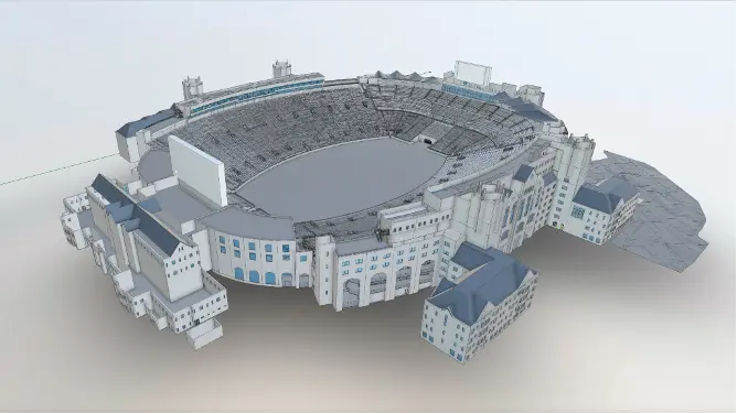
Why Universities Leverage Laser Scanning and BIM for Their Campuses

Why Do Universities Leverage Laser Scanning and BIM for Their Campuses?
Finding your way around a big university campus is notoriously tricky. To make campuses less intimidating and easier to navigate, schools have been creating interactive 3D maps for students and visitors. The most accurate and effective way to do this is by using building information modeling (BIM) documentation and laser scanning. It’s no surprise major institutions like Tufts University regularly leverage this technology.
Digital Records
Laser scanning and BIM gives you a precise digital record of a campus. It provides you with critical information, including more accurate measurements than you get from manual measurements. In the past, campus mapping was a time-consuming and far less accurate process. Maps often weren’t to scale, making it much harder to use them to find your way around an intricate campus.
Using Existing Condition’s laser scanning technology, you get so much more than point to point campus measurements. In fact, you get billions of points of data that are turned into a colorized, interactive 3D representation of the campus.
Benefits
The benefits of leveraging 3D laser scanning and BIM documentation for university campuses don’t stop at creating 3D maps. When it comes time to renovate or remodel, this information gives you the most accurate as-built dimensions available.
Laser scanning and BIM documentation is far more accurate and precise than manual measurements. But its benefits extend further than accuracy and precision. The time it takes to do laser scanning of a major campus is minuscule compared to the time it takes to manually measure every point of the grounds.
It's Simply a Better Method
Additionally, laser scanning is a much less intrusive process than manual measuring. There’s no need for big shut-downs and interruptions while the scanning takes place. Existing Conditions deploys small, uniformed crews on site with a small tripod-mounted 3D laser scanner. From time to time, we may also use other noninvasive equipment to get the job done. Depending on the scope, we typically will move around the exterior and interior perimeter of the campus and building roofs to collect scan data.
No campus is too big or too small to benefit from laser scanning. We work on building and projects of all sizes, from small academic and dormitory spaces up to entire university campuses and institution-wide documentation.

Existing Conditions 3D Laser Scanning Services
Over the past 27 years, Existing Conditions has measured, documented, and modeled over 10,000 buildings spanning over 700 million square feet across the United States, establishing ourselves as an industry leader in 3D laser scanning. Building professionals trust us to deliver digital representations of the as-built environment with unparalleled accuracy and efficiency. Our dedicated Project Managers provide fast and accurate 3D laser scanning services and drone imagery services, and expert CAD and BIM technicians create custom, detailed deliverables, including point clouds, 2D CAD drawings, 3D BIM models, 3D mesh models, TruViews, and 3D virtual tours. Our greatest reward remains delivering superior-quality scan-to-BIM work and knowing we played a vital role in our clients’ projects.
Would you like to learn more about laser scanning for university campuses as well as BIM documentation for a variety of industries? Get in touch with us today.
FAQs
How Does Laser Scanning Work?
.svg)
One primary method is that a laser scanner sends light pulses at high speeds which reflect off objects and return to the scanners’ sensor. For each pulse, the distance between the scanner and object is measured by determining the elapsed time between the sent and received pulses. Each point of the scan will be converted to a pixel with a known x-, y-, and z- coordinate. Laser scans or LiDAR scans are taken in multiple positions around a site from varying viewpoints. Millions of data points are captured and processed into a point cloud, creating an accurate data set of the structure or site.
How Accurate is the Point Cloud and BIM Model?
.svg)
Point clouds are a digital representation of spatial information, stored as a collection of points with three spatial coordinates. They are millimeter-accurate and are scanned in the level of detail required for your project. BIM model features are created to your project-specific scope, LOD specifications can vary throughout the model. By specifying scope and project details, BIM models can be customized to your project.
What is Scan-to-BIM Used For?
.svg)
Scan-to-BIM is a process that uses 3D laser scanning to create a building information model of a building or site. BIM models provide a comprehensive view of a building that can be used throughout its lifecycle – during the design phase, construction phase, and operation phase of the building. The BIM model can be used during the design and planning stages of a project from design changes to material selection, and cost estimation. During the construction phase, the model can be used to coordinate and manage different trades and ensure the building is constructed according to the design intent. During the operation phase, the model can be used to manage maintenance and repairs, track the performance of the building, and plan for future improvements.


%20for%20an%20industrial%20facility.webp)


