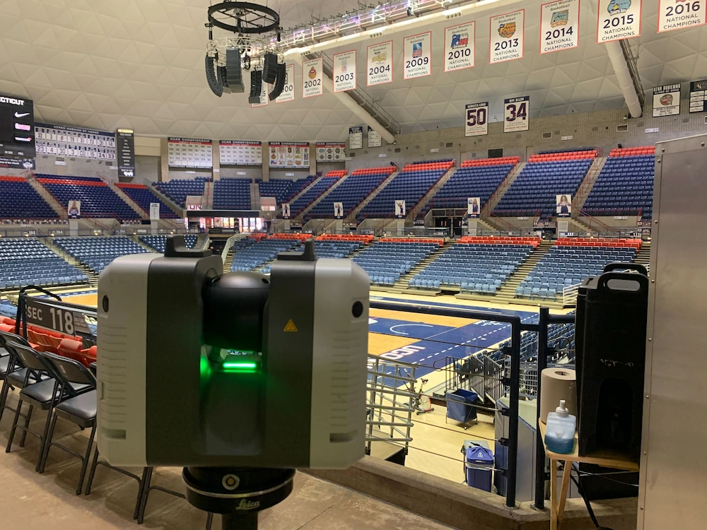
Why Does Our Company 3D Laser Scan with Leica Laser Scanners?

The Leica series of 3D laser scanners is professional grade, offering outstanding range, speed, and the highest quality 3D data for your project. Leica Geosystems has been a leader in 3D laser scanning for more than 20 years, and their history of precision measurement tools goes back over 200 years. They offer premium products and innovative solutions to provide 3D laser scanning services for many industries, such as architecture, engineering, construction, manufacturing, healthcare, water treatment facilities, education, entertainment, aerospace, government, defense, and more.
Leica Geosystems offers a complete 3D laser scanning solution with precise and accurate equipment and sophisticated software. Leica P-Series ScanStations can tie to survey control, achieve 2-4mm accuracy, and have real time liquid filled dual axis compensation to help mitigate movement and ensure level scans.
What Leica 3D Laser Scanners Do We Utilize for Data Capture?
Leica ScanStation P50 | Leica ScanStation P40
Leica P-Series ScanStations deliver the highest quality point cloud data and HDR imagery at an extremely fast scan rate of up to 1 million points per second and ranges of more than 1 kilometer. The P-series Leica laser scanners can tie to survey control, achieve 2-4mm accuracy and have real-time liquid filled dual axis compensators to help mitigate movement and ensure level scans. With unsurpassed range, survey-grade accuracy, and low range noise, these scanners deliver highly detailed point clouds.
.avif)
Leica RTC360
The Leica RTC360 3D laser scanner combines a high-performance laser scanner with Cyclone FIELD 360, a mobile-device app on a tablet computer, to capture and automatically pre-register scans in real time. With a measuring rate of up to 2 million data points per second and advanced HDR imaging system, you can have a 3D colorized point cloud with 2-6 mm accuracy in under 2 minutes. Automatic targetless field registration and the seamless transfer of data from site to office reduces time spent in the field, maximizing project productivity.
.avif)
Leica 3D Laser Scanners Offer These Advantages:
- High-Speed Data Processing: Leica laser scanners are equipped with powerful processors that enable rapid data acquisition and on-site processing, minimizing time needed for 3D laser scanning and enhancing efficiency on-site.
- High Quality Laser Scan Data: The point cloud from Leica laser scanners is complete, clean, and crisp with no invalid points “floating” in the scan data.
- Geometric Accuracy: The geometry of scanned objects will be correct, other laser scanners may return rounded edges.
- Low Range Noise: Leica laser scanners achieve clean, high-quality scan data with low range noise at a high scan speed. Other laser scanners may require scanning at a lower speed to obtain low range noise.
- Mixed Pixel Filtration: Leica laser scan data is well filtered. The scanner’s on-board and import algorithms are highly intelligent. For example, rain and snow noise is now recognized as noise and is disregarded during the collection and import process using mixed pixel filtration.
- HDR Photo Quality Images: Leica scanners integrate HDR imaging and advanced cameras that capture crisp, detailed images alongside the point cloud data, eliminating the need for separate photo capture and enabling high-quality visual documentation.
- Dual-Axis Compensators: These compensators automatically adjust for the scanner’s tilt or vibration, maintaining precision and reducing setup time even in dynamic environments, which allows for fast, uninterrupted scanning.
- Efficient Data Management: High-speed, high-quality laser scanning gives you the ability to capture a lot of data very quickly. Leica laser scanners store hundreds of gigabytes of data and transfer hundreds of megabytes of data per second. Other scanners rely on an open-format SD card to store and transfer this data and will quickly max out on storage space.
- Real-Time Field Registration: Using Leica’s Cyclone FIELD 360 software, data can be processed and registered in real time, allowing users to verify data accuracy and coverage instantly on-site, saving time on adjustments and re-scans.
- Streamlined Workflow Integration: Leica’s scanning software integrates seamlessly with CAD and BIM platforms, facilitating fast data transfer and immediate use of scanned information in design workflows.
Leica 3D laser scanners are known for delivering highly precise measurements and exact spatial data quickly. Our clients expect their building or site to be documented quickly and accurately and with Leica 3D laser scanners we can offer that.
.avif)
Existing Conditions 3D Laser Scanning Services
Over the past 27 years, we have measured, documented, and modeled over 10,000 buildings spanning over 700 million square feet across the United States, establishing ourselves as an industry leader in 3D laser scanning. Building professionals trust us to deliver digital representations of the as-built environment with unparalleled accuracy and efficiency. Our dedicated Project Managers provide fast and accurate 3D laser scanning services and expert CAD and BIM technicians create custom, detailed deliverables. Our greatest reward remains delivering superior-quality scan-to-BIM work and knowing we played a vital role in our clients’ projects.
Contact us today to learn more about Existing Conditions 3D laser scanning services with Leica laser scanners.
Existing Conditions 3D Laser Scanning Services
Over the past 27 years, we have measured, documented, and modeled over 10,000 buildings spanning over 700 million square feet across the United States, establishing ourselves as an industry leader in 3D laser scanning. Architects, builders, engineers, developers, facility managers, trust us to deliver digital representations of the as-built environment with unparalleled accuracy and efficiency. Our dedicated Project Managers provide fast and accurate 3D laser scanning services and drone imagery services, and expert CAD and BIM technicians create custom, detailed deliverables. Our greatest reward remains delivering superior-quality scan-to-BIM work and knowing we played a vital role in our clients’ unique and historic projects.


