What is LiDAR?

LiDAR, or Light Detection and Ranging, is a remote sensing technology that uses a pulsed laser to measure distances to a target. 3D laser scanners contain a LiDAR sensor that sends out beams of laser light in all directions and records how long it takes for them to return to the sensor.
Because light travels at a constant speed, the variation can be calculated as a distance; therefore, producing an accurate point in space. Each point of a LiDAR scan will be converted to a pixel with known x, y, and z coordinates.
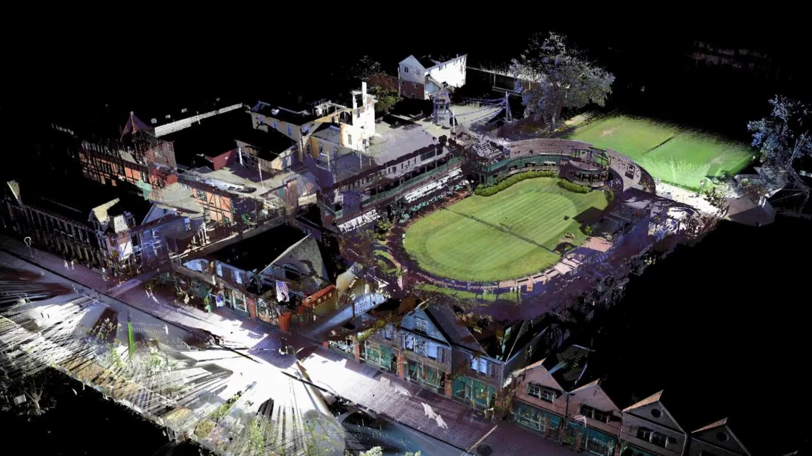
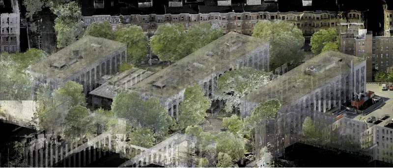
LiDAR scanners repeat this process up to a million times a second, creating a 3D map of the building or site made up of millions of data points, referred to as a point cloud.
What are the Key Components of LiDAR?
- Laser: Sends out light pulses to measure distances.
- Sensor: Detects the reflected light.
- GPS: Tracks the scanner’s exact position for accurate mapping.
- IMU (Inertial Measurement Unit): Measures the scanner's orientation and movement.
How Does Lidar Work?
Using ultraviolet, visible, or near-infrared light, LiDAR maps spatial relationships and shapes by measuring the time it takes for signals to bounce off objects and return back to the sensor. Each of these is recorded in a laser scan. Each individual scan is made up of millions of three-dimensional data points.
Note that each scan is limited to line-of-sight, so multiple scans are needed to provide a comprehensive
3D view of an object or scan area. Entire buildings or campuses will require laser scanners placed in multiple positions around a site to take individual scans from varying viewpoints.

What are the Steps of the LiDAR Process?
- Emission of Laser Pulses: A LiDAR system sends out rapid pulses of laser light toward a target or surface. These pulses are typically in the form of ultraviolet, visible, or near-infrared light.
- Reflection of Light: When the laser pulse strikes an object (like a building, tree, or the ground), it reflects back to the LiDAR sensor. The system then captures the reflected light.
- Time of Flight Measurement: LiDAR measures the time it takes for the laser pulse to travel to the object and return to the sensor. Since light travels at a constant speed, the system can calculate the distance to the object based on the time delay (known as the time of flight).
- Distance Calculation: The formula used to calculate the distance between the sensor and the object is Distance = (Speed of Light × Time)/2. The time is divided by two because the pulse travels to the object and back to the sensor.
- Point Cloud Generation: LiDAR systems rapidly emit and capture millions of laser pulses per second, recording each pulse's distance from the sensor. These data points are known as a point cloud. Each point in the cloud represents a 3D coordinate (X, Y, Z), creating a highly detailed map of the building or site.
- Position and Orientation Tracking: To make accurate maps, LiDAR systems use GPS to track the exact location of the sensor and an IMU (Inertial Measurement Unit) to record the orientation and movement of the scanner. This ensures that all data points are placed correctly in space.
- Data Processing: Once the data is collected, specialized software processes the point cloud to create detailed 3D models. The data can also be filtered to remove noise, enhance detail, and integrate with other datasets like photographs or CAD drawings.
What is LiDAR Used For?
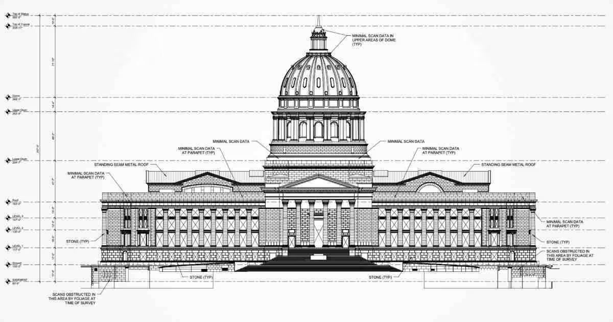
The technology is deployed to collect highly accurate digital measurements and images and is used to create 3D BIM models and 2D CAD drawings of buildings and environments for architecture, engineering, and construction projects. LiDAR technology is fast, accurate, and reliable.

What is Terrestrial Laser Scanning?
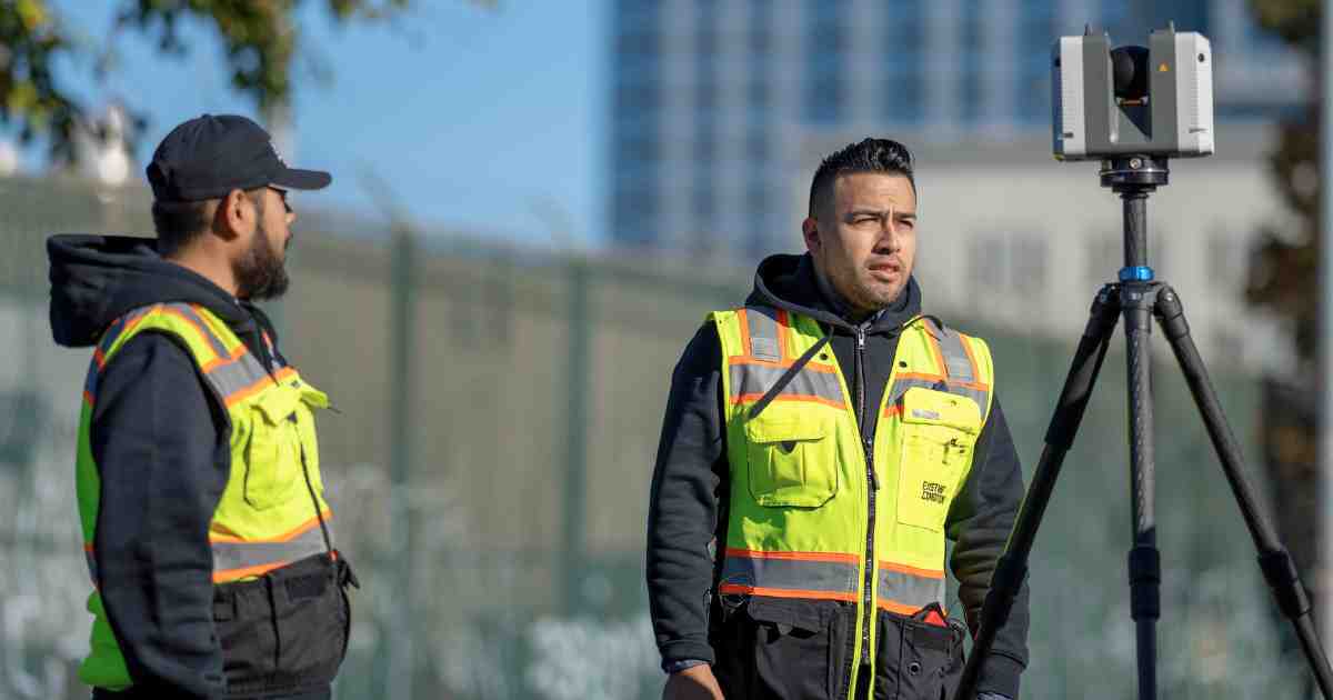
Terrestrial laser scanning is a form of measuring with a tripod-based LiDAR instrument used to capture high accuracy data of buildings and other objects. Terrestrial laser scanning is used to capture existing structures, equipment, utilities, and processes to plan for construction, relocation, modernization, and enhancements.
3D terrestrial scanners are the most accurate form of LiDAR. 3D scanners capture millions of three-dimensional data points, documenting the accurate existing conditions of a structure or site. Data points are processed into a 3D visualization known as a point cloud. The technology enables users to produce highly accurate digital measurements and images quickly and easily.
Why Does the Construction Industry Use LIDAR?

The construction industry is primarily using LiDAR to produce data sets of accurate as-built existing conditions. The data can be used in point cloud format or used to create precise 2D CAD drawings and 3D BIM models. A comprehensive 3D building information model (BIM) provides contractors, engineers, and facility managers the data to effectively plan, design, construct, and manage projects.
Where Can You Apply LiDAR in Construction?
- As-Built Survey: Before starting a construction project, an as-built survey of the structure should be completed to capture exact building dimensions, locations, and layout – information that is crucial to the success of any project.
- 3D BIM Modeling: 3D BIM models are digital representations of a building or site to facilitate design, construction, and operational processes. 3D BIM models provide users with the ability to break down architectural, structural, and MEP building features and see how they fit into a single finalized structure or assign attributes that give them intelligence of their function.
- Clash Detection & Prefabrication: LiDAR data helps to identify potential clashes, fabricate components and plan a flawless installation. LiDAR data saves time, money and headaches by preventing costly modifications in the field.
- Structural Analysis: LiDAR is excellent for monitoring structural deformations, such as subsidence, tilting, or displacement in buildings or other infrastructure. By comparing LiDAR scans taken at different times, engineers can identify changes in the structure’s geometry and detect areas of concern, such as cracks, shifts, or warping.
- Construction Monitoring: Regular LiDAR scans provide a clear record of construction progress over time. By comparing scans taken at different stages of construction, project managers can assess whether the project is on schedule, identify any delays, and track the completion of specific tasks.
- Collaboration and Coordination: Project managers, architects, and engineers can share LiDAR data with their teams to ensure everyone is on the same page and can coordinate their work effectively.

Existing Conditions Performs LiDAR Scanning
LiDAR technology provides accurate and detailed building information for architecture, engineering, and construction projects. Existing Conditions (now a GPRS company) has over 26 years of experience in LiDAR-related services, such as existing condition surveying, mapping, and data collection for professionals in the building industry.
We have the latest equipment and expertise to deliver accurate and comprehensive data for your project. Let us take care of the hard part of this business – we'll handle the field work – while you focus on making smart decisions based on accurate data. If you'd like to learn more about LiDAR 3D laser scanning services, please visit our website, check out our portfolio, or contact us to connect with an Existing Conditions team member.
Existing Conditions 3D Laser Scanning Services
Over the past 27 years, we have measured, documented, and modeled over 10,000 buildings spanning over 700 million square feet across the United States, establishing ourselves as an industry leader in 3D laser scanning. Architects, builders, engineers, developers, facility managers, trust us to deliver digital representations of the as-built environment with unparalleled accuracy and efficiency. Our dedicated Project Managers provide fast and accurate 3D laser scanning services, and expert CAD and BIM technicians create custom, detailed deliverables. Our greatest reward remains delivering superior-quality scan-to-BIM work and knowing we played a vital role in our clients’ unique and historic projects.


