How Do You 3D Laser Scan a Building?
.avif)
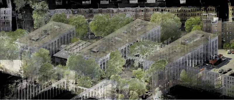
3D laser scanning is the most effective method to obtain precise measurements of a building or project site. This technology captures every detail of the structure, including architectural, structural, mechanical, electrical, and plumbing (MEP) features.
It works at remarkable speeds and delivers unparalleled accuracy. 3D laser scanning provides highly accurate building dimensions, layouts, and locations, enhanced by three-dimensional imagery, making it an ideal service for construction design and project management.
What is the Process of 3D Laser Scanning a Building?
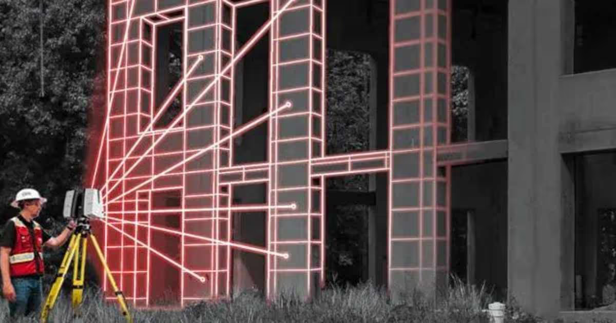
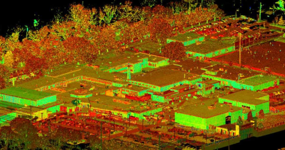
A skilled Project Manager sets up the laser scanner at various locations around the site to capture millions of measurements. These are compiled into a digital map or point cloud. Successful scanning depends on the proper positioning of the scanner, which requires training and site awareness. It's not simply about pressing a button; careful planning is essential for accurate results.
What are the Steps to 3D Laser Scanning a Building?
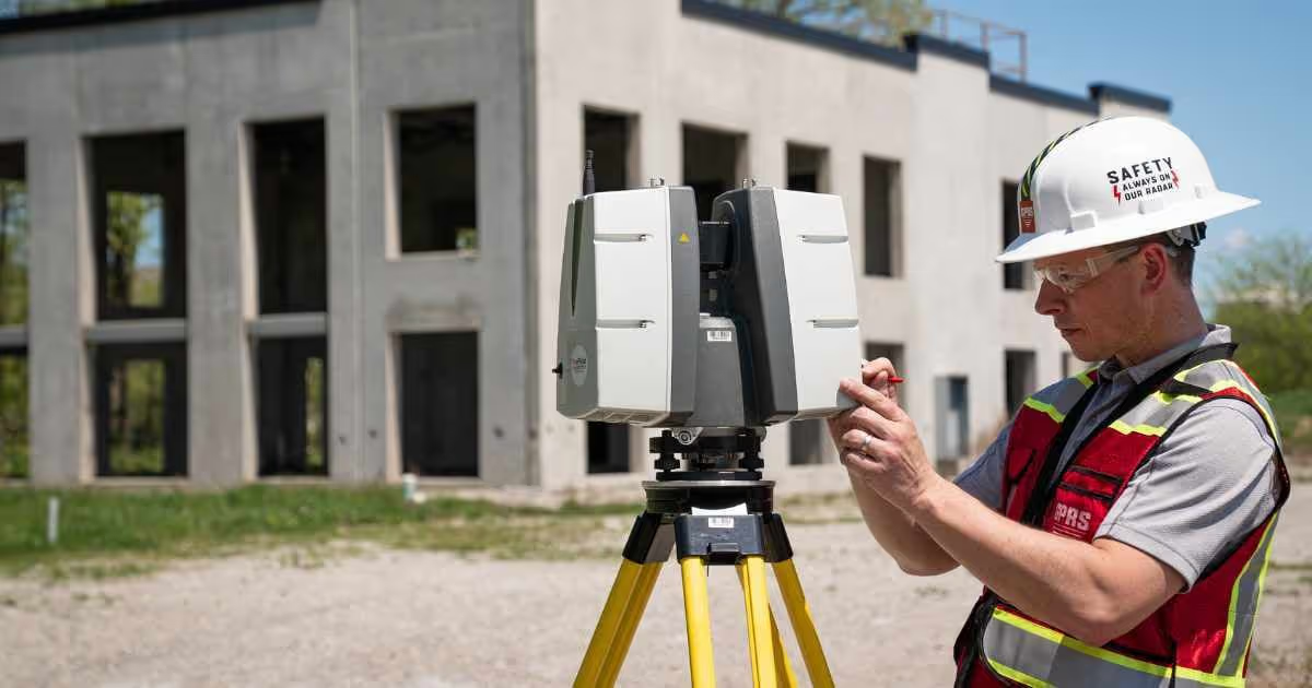
- Choose the Right Laser Scanner: A laser scanner is selected based on the size and complexity of the building, the project timeline, and the level of detail required.
- Mount the Scanner to a Tripod: Set the scanner on a tripod to provide accurate and consistent data.
- Calibrate the Scanner: Perform a calibration process, often by scanning a known target, to guarantee accurate measurements.
- Define the Scan Area: Divide the building into manageable sections, considering factors like size, complexity, and accessibility.
- Set Control Points: Mark control points within the building to serve as reference markers, helping to merge scans into one complete point cloud.
- Begin Laser Scanning: The laser scanner emits laser beams that bounce off surfaces and are recorded by the scanner's sensors. For each pulse, the distance between the scanner and object is measured by determining the elapsed time between the sent and received pulses. The laser scanner collects millions of data points, creating a point cloud representing the building's geometry. Be sure to ensure sufficient overlap between individual scans to facilitate accurate alignment during post-processing.
- Register the Scans: All scans are registered together during post-processing, removing the noise and setting the coordinate system to provide the most precise measurements.
- Create a Point Cloud: Use specialized software to merge and align the individual scans into a unified point cloud. This process involves identifying common features and control points.
- Clean and Filter the Data: Remove any unwanted noise or outliers from the point cloud to enhance data quality.
- Convert the Data to 2D Drawings and 3D Models: The refined point cloud can be transformed into 2D CAD drawings, 3D BIM models, 3D mesh models, TruViews, or virtual tours.
Why are Point Clouds Important?
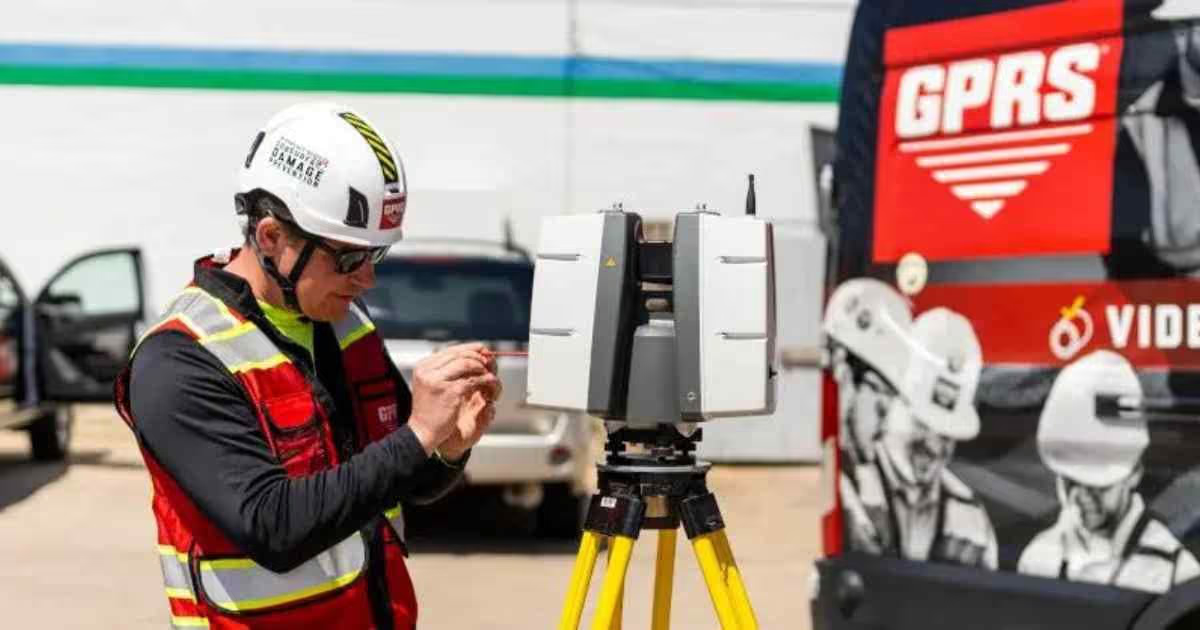
Point clouds represent spatial data through millions of x, y, and z coordinates. They offer dynamic, detailed information for analysis and decision-making, streamlining project planning and execution.
Is Data Processing Required?
After scanning, the data must be processed. This involves aligning the individual scans to create a unified 3D model. The process is similar to assembling a 3D puzzle, where overlapping points are matched to ensure accuracy.
How Can I Use the 3D Scan Data?
Point cloud data can be used for various purposes, including creating 2D drawings and 3D BIM models. Clients can even overlay 3D models onto the point cloud for clash detection. Additionally, 3D mesh models can be generated, converting the point cloud into a solid object for further use in CAD software. TruViews and virtual tours also provide enhanced site visualization and planning.
What are the Benefits of 3D Laser Scanning?
A 3D laser scan captures everything within line of sight up to 1,000 meters in a full 360 degrees from every scan location. A single laser can capture millions of 3D data points per second, providing incredibly rich dimensions of every aspect of your site. This comprehensive scan reduces the need to revisit the project to answer unanticipated questions. Laser scanning is quick, safe, and non-intrusive – minimizing or eliminating operational shutdowns and client inconvenience. 3D laser scan technology reduces risks, enhances design accuracy, and helps avoid change orders.
What 3D Laser Scanning Equipment Do We Use?
At Existing Conditions, we employ a comprehensive range of laser scanning equipment sourced from reputable companies like Leica, NavVis, and FARO. We meticulously select the scanner that best aligns with the specific requirements of each project, ensuring optimal data quality and accuracy.
How Long Does 3D Laser Scanning Take?
An individual scan usually takes between 1-2 minutes. The Project Manager will set up the scanner in multiple positions around the building or site. Most building scanning projects can be laser scanned in as little as a couple of hours or larger sites in a few days. Entire facilities or campuses can take several weeks to capture the entire site, but most projects are scanned in a few hours or one day.
How Much Does 3D Laser Scanning Cost?
Estimating project costs is a critical aspect of any construction project, and at Existing Conditions, we take a customized approach to ensure affordability and precision. Our existing condition surveys are designed to be the most cost-effective solution for your unique needs.
Key points to consider:
- Tailored Quotes: We understand that every project is distinct, with its own set of requirements and challenges. Therefore, we provide custom quotes based on the specific building, project scope, and individual needs. This tailored approach ensures that you receive accurate pricing aligned with your project's unique demands.
- Proven Track Record: With almost 27 years of experience in the field, we have consistently saved our clients both time and money. Our commitment to delivering superior quality work, on time and within budget, sets us apart.
- Expertise and Equipment: Our dedicated team brings a wealth of expertise to the table, backed by high-quality equipment and technology. We leverage our experience and resources to provide you with the best possible project outcomes.
- Request a Quote: To discover how our services can meet your project's needs while staying within your budget, please click here to initiate the quotation process.
At Existing Conditions, we prioritize delivering exceptional building documentation services that align with your project's financial parameters and goals. Our commitment to affordability and quality ensures that you receive the most cost-effective existing conditions surveys available. Click here to find out how to get a quote.
Existing Conditions 3D Laser Scanning Services
Over the past 27 years, we have measured, documented, and modeled over 10,000 buildings spanning over 700 million square feet across the United States, establishing ourselves as an industry leader in 3D laser scanning. Architects, builders, engineers, developers, facility managers, trust us to deliver digital representations of the as-built environment with unparalleled accuracy and efficiency. Our dedicated Project Managers provide fast and accurate 3D laser scanning services, and expert CAD and BIM technicians create custom, detailed deliverables. Our greatest reward remains delivering superior-quality scan-to-BIM work and knowing we played a vital role in our clients’ unique and historic projects.


