How Do Engineers Benefit from Laser Scanning and BIM?

Engineering firms around the world like VHB, Jensen Hughes, and Stantec have been leveraging Existing Conditions 3D laser scanning and BIM expertise for decades. The data from laser scanning and BIM documentation is an invaluable tool with many benefits throughout the scope of an engineering project.
How Do Engineers Benefit from 3D Laser Scanning and BIM?
As more and more engineering firms adopt the use of sophisticated 3D laser scanning technology, its benefits are beginning to be better understood. Notably, laser scanning adds a level of efficiency to any design project that can’t be achieved with traditional methods. With this increased efficiency comes reduced costs, materials, mistakes, and ultimately time.

Analyzing Large Buildings
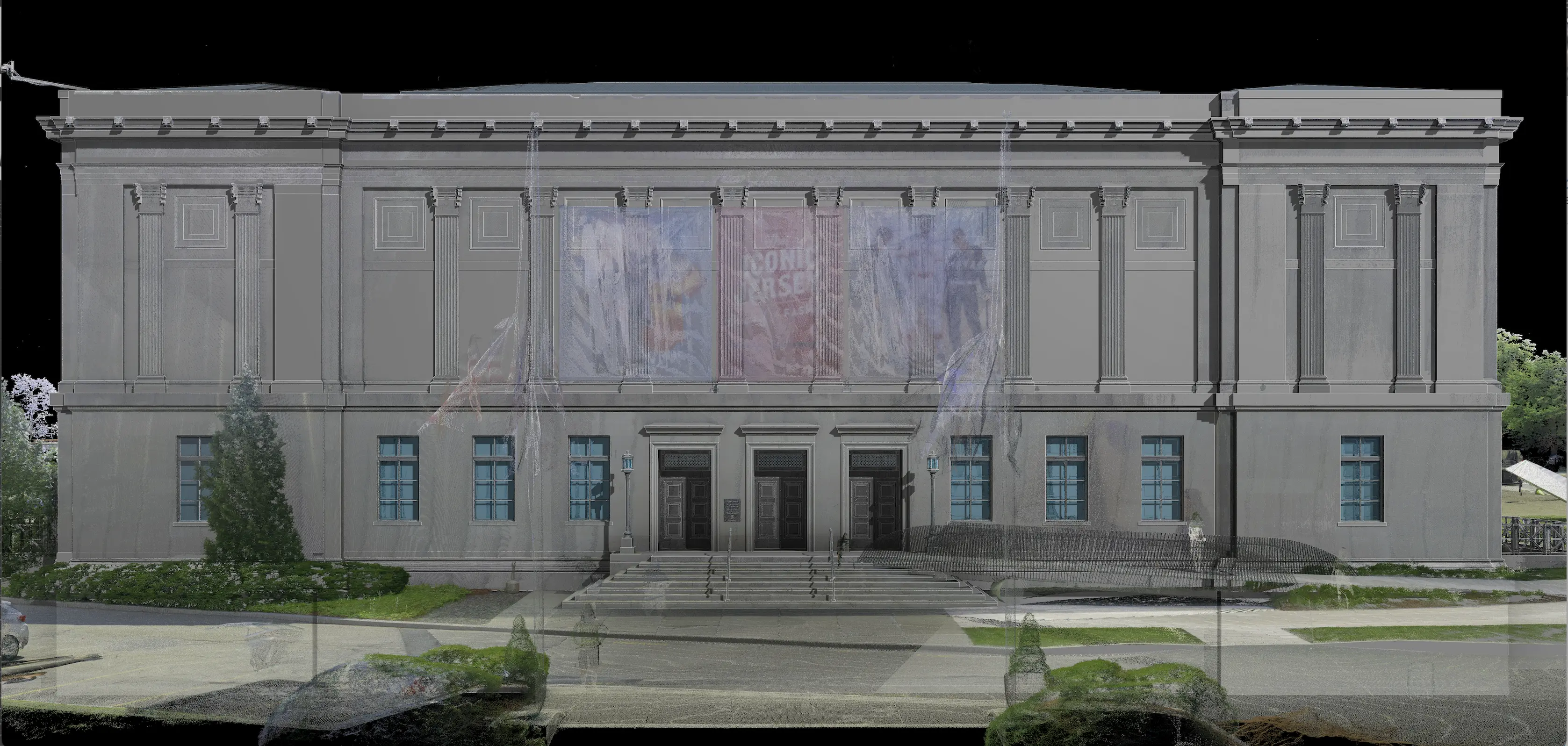
3D scanning is particularly useful during large projects, like major renovations or new construction sites. Using laser scanning data, you’re able to get an accurate, panoramic view of a new job site. From there, you can use this information for real-world applications like creating fully textured 3D BIM models and detailed as-built plans and elevations. When you’re working on an existing location for renovations or remodeling, you’ll have accurate, up-to-date documents and information about the structure and surrounding property that you couldn’t easily get otherwise.
Safety
Utilizing laser scanning for construction and engineering projects has incredible safety benefits as well. With an accurate digital model at your fingertips, you’re able to access plans and information from anywhere. This means fewer site visits with clients, helping to keep you both safe and also minimizing interruptions to the workflow at the site. This also allows you to identify potential vulnerabilities in a project to keep on-site staff safer as well.
BIM for Engineers
A laser scanner gathers the millions of data points it needs to create a digital footprint. Then, this information can be uploaded to building information (BIM) software. At Existing Conditions, 3D laser scan data can be delivered in a variety of formats. Our drawings are primarily delivered in either AutoCAD .DWG file or Revit .RVT file, but we can also export to all known CAD platforms as well as PDF format.
Existing Conditions 3D Laser Scanning Services
Over the past 27 years, Existing Conditions has measured, documented, and modeled over 10,000 buildings spanning over 700 million square feet across the United States, establishing ourselves as an industry leader in 3D laser scanning. Building professionals trust us to deliver digital representations of the as-built environment with unparalleled accuracy and efficiency. Our dedicated Project Managers provide fast and accurate 3D laser scanning services and drone imagery services, and expert CAD and BIM technicians create custom, detailed deliverables, including point clouds, 2D CAD drawings, 3D BIM models, 3D mesh models, TruViews, and 3D virtual tours. Our greatest reward remains delivering superior-quality scan-to-BIM work and knowing we played a vital role in our clients’ projects.
Our business was founded to deliver high quality building documentation more accurately, efficiently and cost effectively than anyone else in the market. We’ve been committed to doing this since 1997. Would you like to find out more about how engineering firms leverage the power of laser scanning and BIM for their businesses and what it can do for you? Get in touch with us today.
FAQs
How Does Laser Scanning Work?
.svg)
One primary method is that a laser scanner sends light pulses at high speeds which reflect off objects and return to the scanners’ sensor. For each pulse, the distance between the scanner and object is measured by determining the elapsed time between the sent and received pulses. Each point of the scan will be converted to a pixel with a known x-, y-, and z- coordinate. Laser scans or LiDAR scans are taken in multiple positions around a site from varying viewpoints. Millions of data points are captured and processed into a point cloud, creating an accurate data set of the structure or site.
What are As-Built Drawings?
.svg)
As-built drawings are the set of accurate record drawings for a project. They reflect all changes made during the construction process and show the exact dimensions, geometry, and location of all building elements and infrastructure. As-built drawings can also be referred to as 2D CAD drawings and deliver site plans, floor plans, interior elevations, exterior elevations, sections, details, isometric drawings, mechanical and electrical MEP drawings, reflected ceiling plans RCPs, and more.
What are the Benefits of 3D Laser Scanning?
.svg)
3D laser scanning captures millions of 3D data points per second for each scan location, providing incredibly rich data of a building or project site. Sites are captured in high detail the first time, eliminating disruption and the need for return visits. Datasets are dimensionally accurate, measurable and shareable, expediting project planning and execution. Accurate design plans are produced from the start expediting field work and reducing change orders, delays and costs. Communication is improved, teams can discuss plans while each has access to the same information, creating a more dynamic working environment.


