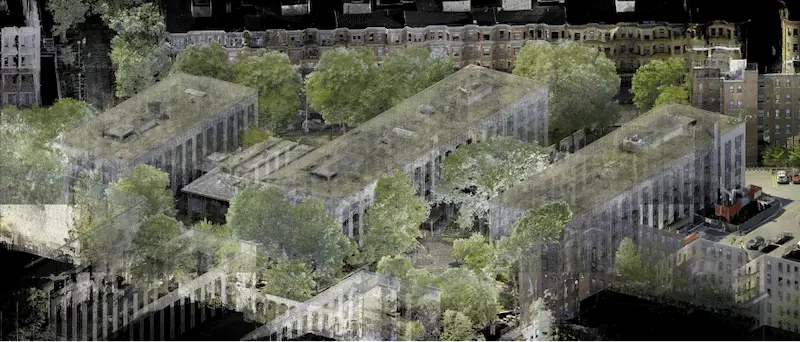
Can Point Clouds Be Converted to 3D Mesh Models?
.avif)
Creating 3D Mesh Models from Point Clouds for Architects & Other Professionals
These datasets are essential in the architectural field, capturing millions of high-density points that define the geometry of a site or object in 3D space. The next step for architects looking to utilize this data in CAD environments is to convert these point clouds into 3D mesh models.

At Existing Conditions, now a GPRS company, we specialize in transforming LiDAR-generated point clouds into detailed 3D mesh models in a variety of file formats, including .fbx, .stl, .obj, and .ply. Using high-resolution laser scanners, our project managers meticulously gather point cloud data from project sites. These data sets are then processed by our in-house CAD team to create volumetrically accurate, high-density mesh models.
Why Convert Point Clouds to Mesh Models?
Meshes offer a streamlined alternative to working directly with point clouds, which can be challenging to manipulate within traditional CAD software. By converting a point cloud into a mesh, architects can more easily view, analyze, and interact with complex geometries. Meshes are ideal for representing objects with intricate or organic details that are difficult to reproduce accurately in CAD formats.
Applications of Mesh Models in Architecture
3D mesh models are valuable in a range of architectural applications, particularly for:
- Historical Building Facades and Structural Elements: Facilitating restoration or reconstruction projects with high geometric fidelity.
- Sculptures, Statues, and Artwork: Preserving fine details in digital formats for documentation or replication.
- Large-Scale Objects: Modeling vehicles, equipment, or other objects for integration into design proposals.
- Landscape Features: Creating digital replicas of trees and natural features to be incorporated into site plans or visualizations.
- Film and Entertainment Sets: Assisting with digital set design or virtual reality environments.

Our Expertise
Existing Condition’s Mapping and Modeling Team comprises experienced engineers and CAD technicians dedicated to producing mesh models that meet the standards of architects and designers. All our CAD work is performed in-house, ensuring consistent quality and a deep understanding of each project's unique requirements. Our goal is to help architects visualize the built world with precision, enabling accurate planning, design, and project execution.
Ready to see your vision take shape? Existing Conditions can help you convert your point cloud data into detailed, usable 3D mesh models that support your architectural needs.
GPRS + Existing Conditions – Intelligently Visualizing The Built World®.
What can we help you visualize?
Existing Conditions 3D Laser Scanning Services
Over the past 27 years, we have measured, documented, and modeled over 10,000 buildings spanning over 700 million square feet across the United States, establishing ourselves as an industry leader in 3D laser scanning. Architects, builders, engineers, developers, facility managers, trust us to deliver digital representations of the as-built environment with unparalleled accuracy and efficiency. Our dedicated Project Managers provide fast and accurate 3D laser scanning services, and expert CAD and BIM technicians create custom, detailed deliverables. Our greatest reward remains delivering superior-quality scan-to-BIM work and knowing we played a vital role in our clients’ unique and historic projects.


